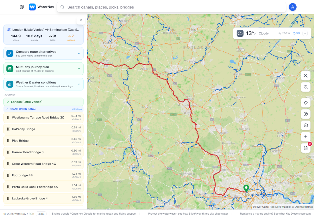
RIVER CANAL RESCUE has upgraded the functions on its free inland waterway mapping tool WaterNav.
This giving boaters additional long-journey planning resources, and more detailed weather and water information.
Improve journey options
The route-planning system has been overhauled to improve journey options, increasing its speed and efficiency, and WaterNav will instantly calculate the miles, locks and journey time, including POIs, overnight stops and different routes. Boaters can also access localised weather forecasts, flood alerts, river levels and observed tide information via the web and app versions.
The new web version allows planned routes to be shared with mobile devices and gives RCR members live call-out updates on engineers’ locations and progress reports/work completed on booked-in jobs.
WaterNav’s My Boat section, previously only available on the web, is now on the mobile app, giving RCR members the same access to live engineer call-out updates and fault reports/booked-in jobs, as well as membership information. All users can log their boat details, journeys and routes.
The system’s SOS function uses a data signal, instead of network coverage, to plot the phone’s GPS co-ordinates and What 3 Words location, to summon RCR help.
Returns results in seconds
RCR managing director, Stephanie Horton, explains:
WaterNav would previously take a few minutes to calculate complex routes, for example with multiple waterways or paths, whereas now, it returns results in seconds. In a live test, the system took under a second to return a 10 day journey of around 97 miles, with 61 locks and stopping locations.
“Changes can be easily made to the route, without needing to create a new journey, and alternative routes can be added and saved, allowing users to compare journey times, locks, restrictions etc. And once you tell WaterNav how many hours a day you want to travel, it will split longer journeys into manageable days, recommending nearby facilities and where to moor-up.
“Our live weather and water information is now more accurate and relevant to either the user’s GPS location or the planned journey, rather than displaying everything in the surrounding area, giving greater reliability. And identifying the user’s position within a 5m radius is invaluable in emergency situations or when cruising on rivers with no access.”
Available on browsers and mobile apps, WaterNav is compatible on multiple devices.
To access via a web browser, go to https://web.waternav.co.uk/ and download as an app, or go to Google Play or the App store.
Find out more about River Canal Rescue at https://www.rivercanalrescue.co.uk/waternav-app/ or follow the team on Facebook.